May 17, 2010 - By Dr. Joseph S. Maresca
Continuing Efforts to Contain and Clean-up the Gulf Oil Spill
The estimate seems low based upon assumptions that there are deep-water oil wells in the Gulf of Mexico capable of producing >1.26 million gallons (30,000 barrels) of oil per day under controlled flow rates. The oil slick continues to grow in size even though it's been tackled by a host of skimmer vessels, burning, chemical dispersants, and various natural processes.
If the spill estimate is underestimated, BP and the various government responders run the risk of designing an inadequate new spill-response system that is doomed to fail the next time something like this happens. The well is being sealed by pumping mud into it. A practical concern is dispersing poisons throughout the Gulf. Areas around the plume have reduced oxygen levels. Jelly fish, worms and other sea creatures require oxygen. If oxygen is drained from the ecosystem--every living thing will suffer within close proximity.
Energy giant BP on Sunday marked its first success at containing oil that is gushing unabated into the Gulf of Mexico. The company indicated that it may be able to stop the flow permanently in about a week. BP succeeded in inserting a tube into the leaking well and capturing some oil and gas.
The underwater operation involves guiding robots to insert a small tube into a 21-inch pipe, known as a riser, to funnel the oil to a ship at the surface. "It's working as planned and we are very slowly increasing the rate that is coming from the riser tool up to the surface," according to a BP senior executive vice president. "So we do have oil and gas coming to the ship now," according to the company executive.
Not all of the oil will be trapped, and more time will be required to determine just how much oil has been siphoned successfully. Preparations for a maneuver to inject mud into the well to stop the leak for good are ongoing and will be completed in seven to 10 days according to industry sources.
The insertion tube is a five foot long steel pipe about four inches in diameter with specially designed rubber baffles. The tube will be inserted into the Horizon’s riser to provide a direct connection. The direct connection, combined with the injection of methanol, will minimize the formation of hydrates that could block the flow of hydrocarbons. The riser insertion tube will be installed about 600 feet from the wellhead.
The insertion tube will be connected to a 5,000 foot riser that will convey the hydrocarbons to the Transocean Discoverer Enterprise drillship on the surface. Once in place, oil will flow up into the Enterprise’s riser to the surface. Once at the surface, the hydrocarbons will be processed and oil will be separated from water and gas. The oil will then be temporarily stored before being offloaded and shipped to a designated oil terminal onshore. The Enterprise is capable of processing 15,000 barrels of oil per day and storing 139,000 barrels. A support barge will also be deployed with a capacity to store 137,000 barrels of oil.
This riser insertion tube is on site and is being prepared for installation in the next few days. ROVs will assist in the installation and connections to the riser (tubing) back to the surface. Source: BP
There are reports of huge oil plumes in the Gulf -- including one as large as 10 miles long, three miles wide and 300 feet thick as the crisis continues to approach the one month disaster anniversary.
Crude oil has been gushing unchecked into the sea from a ruptured well about a mile under the ocean's surface, threatening an ecological and economic calamity along the U.S. Gulf Coast. The spill began after an April 20 explosion on the Deepwater Horizon rig killed 11 workers. The spill event threatens to eclipse the 1989 Exxon Valdez spill off Alaska as the worst U.S. ecological disaster. The success yesterday followed a previous setback, when a cord taking the oil to the surface was entangled.
There are a series of possible measures for stopping the flow of oil from a ruptured underwater well. i.e. To slow the flow of oil significantly, the engineers would like to drill a relief well. This would involve a separate well drilled in a key location into the reservoir formation. Once the well is functioning, a series of quick, high-pressure steps are followed to eliminate the existing well. Salt water is pumped into the reservoir, followed by mud and concrete. The mud and concrete seal the space between the oil-bearing formation and the sea bottom assuming a successful result. The extreme depth of the presently leaking well is nearly 5,000 feet or a mile below the ocean surface. This depth will make the whole process more complicated, time-consuming, unpredictable and costly.
The initial containment cap used to cover the ruptured well was unsuccessful due to the problems underneath the submerged cap. New oil wells often release a considerable amount of natural gas together with the oil. The hydrates form groups that have a slush-like consistency. Assuming high concentrations of hydrates in the water, the result has a consistency of an icy slush. The slush is known to be rigid enough to clog equipment and pipelines further complicating the recovery effort.
The ideal boom would have the oil-skimming capability built in. The cost of enhanced booms with such a capability is significantly greater than that of unsophisticated boom apparati. Planes have been dropping a chemical dispersant onto the oil slicks. The ocean wave Mohr-like forces may mix the dispersants but are troublesome for the booms attempting an oil containment. There are of course risks inherent in adding over 100,000 gallons of dispersants into a pristine waterway. The environmental impact is not fully understood at this time. There are risks of pollution to the Gulf, deterioration of the Mississippi River, local wetlands, estuaries and other similar ecosystems and processes. Naturally, the risks of toxin releases are higher until a comprehensive cleanup has been accomplished.
Ideally, oil from the slicks would be captured and brought to shore for processing. There are still many uses for the oil but in most cases all the water and salt must be removed from it - a difficult, expensive and time-consuming task in view of the large quantity of material. With the quantities of oil present in the Gulf, tremendous storage capacity would be required to hold the oil/water mixture before it could be processed.
An emergency refinery that has this oil/water separation capability would be helpful but I doubt that such a capability exists for this specific project.
Nick Pozzi, an engineer with Saudi Aramco in the Middle East cited an accident there in 1993 which generated a spill far larger than anything the United States has ever seen. An engineer who witnessed a crude spill in the Persian Gulf in 1993 says BP should use a fleet of empty supertankers to suck crude off the water's surface.
According to Pozzi, that mishap dumped nearly 800 million gallons of oil into the Persian Gulf, which would make it more than 70 times the size of the Exxon Valdez and the current Gulf spill. Remarkably, by employing a fleet of empty supertankers to suck crude off the water's surface, Pozzi's team was able to clean up the spill and salvage 85 percent of the oil concurrently.
There are disaster possibilities in the Gulf other than oil spills. The possibilities include hurricanes, Tsunamis and underwater earthquakes. An earthquake in any coastal region might lead to a tsunami. The event depends upon the kind of motion caused by the earthquake. A tsunami requires a massive displacement of water. In the case of the recent Asian tsunami, a part of the earth's crust collapsed as two tectonic plates collided displacing a lot of water subsequently causing a huge upswelling that led to the tsunami event. If all the conditions precedent are met -- a big earthquake can lead to displacement of the earth's crust precipitating a massive displacement of water thereby leading to a dangerous tsunami in the Gulf of Mexico or anywhere along the coastal USA.
Earthquakes don't always create tsunamis because such events rarely happen along a subduction zone. A subduction zone describes a condition wherein two tectonic plates move toward one another, converge and lift, releasing a tremendous amount of pressure . This dynamic becomes the focal point for a tsunami. Luckily, the rates of subduction are very slow to occur during the year, with the average rate of convergence being well under a foot per year. More tsunamis are created around Alaska and Japan because the tectonic plates in these vicinities move vertically and are subduction zone spheres as opposed to the California San Andreas fault which has horizontally moving tectonic plates.
A map on the USGS website shows the relative extent of influence of the New Madrid Faultline, which is quite dramatic. An 1895 Charleston, MO quake covered the eastern half of the US, including the states central to the New Madrid fault line. i.e. Ohio, Kentucky, Tennessee, Arkansas, Missouri, Illinois, and Indiana. The impact reached at least half of the states of Wisconsin, Michigan, Pennsylvania, Virginia, North and South Carolina, Georgia, Alabama, Mississippi, Louisiana, Oklahoma, Kansas, and Iowa, and crossed the border into New York and Florida. An important issue to consider is the possibility of earth tremors beneath the sea in the region of the Gulf of Mexico, as well as the potential impact of a major earthquake along the New Madrid Faultine and the fallout as far as the Gulf.
The most widely felt tremors in North America were a series of four that hit near New Madrid, Missouri in the 54 days from December 16, 1811 through February 7, 1812. They ranged from magnitude 7.6 to 8.2. The largest was felt from the East Coast to the Rocky Mountains and from Canada to the Gulf of Mexico. New Madrid also represents an intracontinental fault system.
Source: Satellites Reveal Earthquake Faults Along Eastern U.S. By Robert Roy Britt Senior Science Writer posted March 22, 2000 on Space.com
There are samples of patent art that can be used for oil spill recovery and reuse. For instance, the Oil Spill Containment and Recovery System - US Patent 5328607 by Wyman T. Soule may be useful for this purpose.
The Oil Spill Containment and Recovery System relates to confining and collecting oil spills wherein the oil spill is surrounded and contained within a floating barrier and the oil is pumped from within the enclosure defined by the floating barrier into floating reservoirs proximate to the barrier. The floating barrier utilizes an elongate inflatable buoyant member and an elongate suction conduit depending downwardly from the buoyant member and having a plurality of apertures formed therein through which oil flows into the suction member.
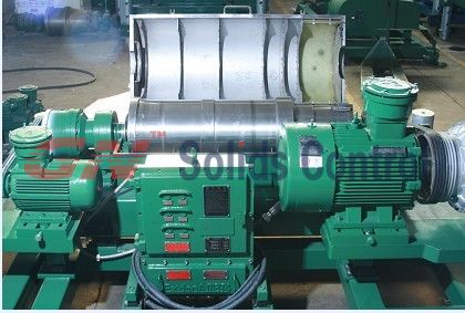
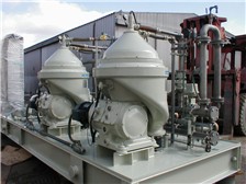
The inflatable member is inflated with air to obtain the desired buoyancy. The weight means depends downwardly from the suction conduit to maintain the buoyant member and suction conduit in a desired orientation to facilitate containment and collection of the oil spill. The buoyant member is collapsible into a substantially flat configuration such that the floating barrier and conduit can be wrapped about a reel in a compact manner which facilitates storage and transportation thereof. A pump in fluid communication with the suction conduit effects oil flow from the suction conduit to a centrifuge which separates water from the collected oil. The oil is then pumped to a floating reservoir proximate the floating barrier.- US Patent 5328607 Inventor: Soule; Wyman T. (Laguna Hills, CA)
NOAA’s Damage Assessment Remediation and Restoration Program (DARRP) is conducting a Natural Resource Damage Assessment (NRDA). From past experience, NOAA is concerned about oil impacts to fish, shellfish, marine mammals, turtles, birds and other sensitive resources, as well as their habitats, including wetlands, mudflats, beaches, bottom sediments and the water column. Any lost uses of these resources, for example, fishery and beach closures, will be evaluated. The focus currently is to assemble existing data on resources and their habitats and collect baseline (pre-spill impact) data. Data on oiled resources and habitats are also being collected.
Important Contacts : National Oceanic and Atmospheric Administration (NOAA)
* For NOAA media inquiries, please contact nos.media@noaa.gov
* For response-related inquiries, please phone the Joint Information Center (JIC) at 985.902.5231 or 985.902.5240.
* To report oil on land, or for general community information, please phone 866.448.5816.
* To report oiled or injured wildlife, please phone 866.557.1401.
* To learn about volunteer opportunities in all areas and what training is required, please phone 866.448.5816.
* To discuss spill related damage claims, please phone 800.440.0858. (Source: NOAA )
This whole oil spill experience begs for future contingency planning to handle these exigencies methodically by coordination of the public and private sector energy companies. The author believes that planning at a minimum should include the following elements:
*Development of an underwater repair/escalation infrastructure to monitor energy equipment performance and routine repair on a schedular basis by the energy industry and select federal agencies or groups of federal agencies/entities/resources i.e.NOAA, NASA, Army Corps of Engineers, United States Patent Office etc.
*Planned de-commissioning or extensive repairs of energy equipment which does not meet minimum engineering thresholds like mean time between failure or anticipatory repairs scheduled from the purchase of the equipment throughout its life cycle
*Deployment of modern submarine vehicles and unmanned devices for use at great depths
*Research and deployment of new materials and processes for application at great depths beneath the sea
*Scientific algorithmic monitoring and identification of empty supertankers and locations for quick assembly and deployment in major oil spills i.e. transportation models, artificial intelligence "Advice Giving" systems etc.
source: www.basilandspice.com